In my previous post, I mentioned that congestion should be tackled as an economic problem rather than an engineering problem. I think this deserved to have its own post to explain what I meant by that, because it's a very important issue to my mind.
The engineering approach
The typical approach of seeing congestion or vehicle traffic as an engineer problem is supposing that vehicle flows are essentially static, a known input into the model. XXXX vehicles per hours come at the intersection by the south and then go through the intersection towards the north. This value is taken as a constant: no matter how congested the intersection, the same number of people will want to make this movement, at the same vehicle flow. So in that context, all that matters is making sure that the road can take that traffic flow in an acceptable manner.
 |
| The engineering approach to intersection design: traffic flows are an input that once determined is never modified |
So that's an engineering approach, simply assume certain traffic flows and then design the road network to accommodate that "load".
The economic/behavioral approach
The engineering approach is very simplistic because it essentially eliminates humans from the problem, to the point that human beings could simply be absent, the model cares only about vehicle trips. It doesn't ask if having so many trips is good or bad or if these could be reduced, it considers these to be natural constants that must simply be dealt with rather than a sum of individual decisions, decisions that can change if the context changes. The economic approach expands upon the engineering approach by looking at decisions that people make, trying to see why they make it and what alternatives they have.
In the end, a decision to go somewhere can be modelized as an economic decision which has costs and benefits (or "utility" as microeconomists put it if I remember correctly).
Benefits or utility of a trip is generally the desired objective of the trip. The distance traveled is NOT a benefit, there is usually no direct benefit from traveling a certain distance, except on joy rides or pleasure strolls. If you have a convenience store 2 km away and another 10 km away with the same goods at the same price, you will go to the nearest one all the time. Benefits can be of many kinds, for example, the benefit of commuting to work is the income one gets from doing the work. If someone earns 100$ per working day, this can be assumed to be the benefit of the trip to and from the workplace. If he goes to a store or a restaurant, it is the utility of the good or meal he expects to purchase. Etc...
Costs include, of course, the actual monetary cost of the trip, especially marginal costs (costs that are directly incurred by the trip), like gas, parking fees, tolls, transit fare, etc... Fixed costs may or may not be considered, depending on the analysis made, for example, someone who has a car may consider only the marginal cost (gas, maintenance) for individual trips, but in deciding whether to buy a car or not for commuting to work, fixed costs may be considered fully. Costs also include the time that the trip takes, as the time is "spent". That is where speed becomes relevant, by potentially reducing travel time, and thus, the cost of the trip (reducing distance can achieve the same thing). On the other hand, congestion, by lowering speed, increases travel costs in terms of time.
Also, the cost of a minute may vary depending on comfort or perceived safety. For example, biking 10 minutes on a cycle track may be less "costly" in people's minds than 10 minutes on a road with a lot of fast-moving traffic, or 10 minutes on a free-flowing highway may be less "expensive" than 10 minutes sitting in stop-and-go traffic.
So the decision process of an individual measures in some way the expected benefits from a trip, versus the cost of the trip. If the trip's expected costs are higher than the expected utility, then people will then generally not make it. But they also have different alternatives: cars, transit, biking, walking, etc... So people examine these alternatives and select the one they think is best.
 |
| Example of mode comparison for one trip, all modes except walking makes the trip worth it, though using a car is most expensive, as it saves time, it has the highest benefit/cost ratio |
Now, of course people don't bother making these calculations to the cent, but they do some estimates in their minds on some level. Everyone is different, and if you summed up everyone's thresholds together, you would obtain something like a demand curve:
 |
| Hypothetical example of traffic flow "demand curve" showing the traffic flow depending on the cost of making vehicle trips, as congestion increases, or as the cost of travel increases, some people may find other paths, delay trips or shift to other modes like transit, reducing vehicle trips. |
An economic approach to solving traffic/congestion issues would recognize and consider this reasoning. Even the delays provided by the simulation would have a feedback effect on traffic flows and require iterative simulations to achieve a plausible result. As the level of service gets worse, the cost of travel at that point in time increases, encouraging people making elective trips (recreative trips, non-urgent trips, etc...) to temporally displace their trips, or encouraging drivers to find new paths or choosing different modes of transport.
As a traffic engineer who has seen many construction projects come and go, I have seen this process in real life. When a project gets under way, the first few days are the worst, but then people adapt to the new situation by trying new paths or changing their habits in a "trial and error" manner and things slowly get better until a balance is reached.
Considering an economic approach also opens the door to a lot more avenues to solve traffic issues than just increasing road capacity (increasing road supply), you can also implement policies to manage demand. Essentially, the economic approach sees congestion as a matter of demand (number of vehicle trips) exceeding supply (road capacity), which can be compensated either by increasing supply (increasing road capacity) or increasing the price of using roads (through higher travel times and/or direct monetary costs) to decrease demand, rather than merely a matter of a static load applied to a fixed system.
Visually, the process becomes much more complicated with more feedback loops:
 |
| Engineering process revised to include an economic approach to congestion |
One of the reasons why engineers don't like this vision, apart from the added complexity, is the "CHOOSE" part, and the availability of non-engineering policy solutions. Engineers are professionals taught to avoid partiality and who prefer to be neutral experts rather than militants for implementing given social policies, so considering non-engineering solutions makes them feel very ill at ease as they feel it exceeds their job mandate. At the same time, politicians who don't have much vision may simply ask engineers to solve congestion issues, entrusting experts with solving their city's problems. This may create a situation where economic solutions are not considered as the experts asked to study the situation do not think they have been given the mandate to evaluate these policy solutions.
Some ideas of an economic approach to congestion
OK, so there are alternatives to engineering solutions to deal with traffic demand, but what are they exactly? On an economic basis, there are three kinds of reductions of vehicle trips that can be achieved.
I will provide a few examples of different practical ways of achieving this, ideally based on real-life examples. But first, I want to address something. The idea of regulating or influencing individual behavior through policies based on economics often leads to accusations of social engineering. I just want to respond that neutrality in this case is essentially impossible. Streets and roads, by their very design, are public goods except for a few exceptions, as such, funding for them is determined by the public authority responsible for them. Therefore, that public authority is forced to make a choice, and the choice it makes will necessarily affect users' behavior and consumption of that good.
- Spatial and temporal redistribution of trips: in that case, certain trips are delayed or hastened, or go through alternative roads that are less congested. When the costs of congested paths during peak hours become relatively higher than alternatives, then people are less likely to opt for them. This is most effective for elective trips without a fixed schedule or when alternative paths exist, which is not always the case (ex: bridges).
- Elimination of trips: when costs of trips increase, the cost may become higher even than the expected individual benefit of the trip, in which case, the trip can be canceled. In this case, what brings about the change is not relative cost, but the absolute cost of the trip that gets too high for it. This may be a problem for the local economy, but it may also favor the replacement of regional trips by local trips, which may be good for local communities. Commutes are least sensitive to that possibility, because benefits tend to be very high, and during congested times, commutes tend to be the majority of trips, so the ability of this approach of reducing congestion during peak hours is small.
- Favoring travel modes that are more space-efficient: walking, biking and transit all use a lot less space than single-occupancy vehicle. For example, a simple bus line with 12 trips per hour (1 per 5 minutes) can increase passenger throughput by 70% (700 people per hour versus 1 000 people per hour for a regular street lane) while using only 1% of that lane's hourly vehicle capacity. In this case too, the effect comes from relative cost, not absolute cost.
I will provide a few examples of different practical ways of achieving this, ideally based on real-life examples. But first, I want to address something. The idea of regulating or influencing individual behavior through policies based on economics often leads to accusations of social engineering. I just want to respond that neutrality in this case is essentially impossible. Streets and roads, by their very design, are public goods except for a few exceptions, as such, funding for them is determined by the public authority responsible for them. Therefore, that public authority is forced to make a choice, and the choice it makes will necessarily affect users' behavior and consumption of that good.
The default in North America of having public entities take care of roads, widening them when needed and being funded through taxes is an approach that is just as much social engineering as an approach that would have drivers paying tolls and fees with no income from taxes. Allowing people to park for free on the street and mandating high numbers of off-street parking for every development is just as much social engineering as charging street parking 5$ an hour and limiting street parking.
So accusations of social engineering sound hollow. It is impossible for policy to be wholly impartial on that matter. The closest thing would be a complete market-based solution. Hint: that market-based solution would not look anything like current practices.
Letting congestion take care of it
This is the solution that is most often applied, but rarely intentionally. Increasing vehicle capacity is often very expensive and politically contentious in urban areas due to expropriations, so when government budgets are tight or governments are weak, projects to increase road capacity to deal with predicted increases in population of a metro area may be put on ice.
The reasoning of the approach is the following: higher traffic demand increases road saturation and congestion, congestion increases travel time for vehicles on the road, travel time is part of travel cost, so travel cost increases, discouraging trips and so reducing demand. This is the flip side of the "induced demand" theory.
So, is this a good solution? Not really, at least, not on its own.
The biggest problem is that roads do have a major economic role to play in the modern world, for freight and for rapid movement of public and private services. Congestion is much worse for these vehicles than for commuters, because they delay the provision of services and may slow certain economic activities. Congestion can also be disastrous for transit, the alternative mode that is best placed to replace SOV trips during congested commute periods as high demand periods result in higher frequencies (making transit best in peak hours and worse in off-peak periods, the opposite of private vehicles). The slower transit vehicles go, the more expensive they are to run, so if transit runs in mixed traffic, congestion can be disastrous for it. That is what killed the streetcars.
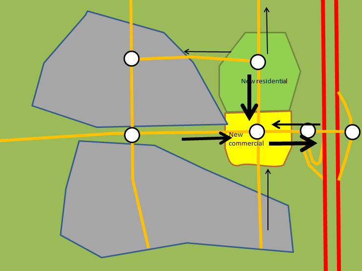
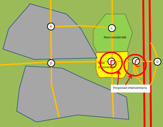
Finally, in terms of development incentives, congestion can lead to sprawl as industries and other developments flee congested areas. Since congestion is rare outside of peak hours, commercial developments are much less affected by it, so having congested arterials do nothing to keep commercial areas in the heart of residential developments.
So, to sum up, developing a greater tolerance for congestion is not bad, but relying exclusively on congestion to regulate traffic is a bad approach.
The biggest problem is that roads do have a major economic role to play in the modern world, for freight and for rapid movement of public and private services. Congestion is much worse for these vehicles than for commuters, because they delay the provision of services and may slow certain economic activities. Congestion can also be disastrous for transit, the alternative mode that is best placed to replace SOV trips during congested commute periods as high demand periods result in higher frequencies (making transit best in peak hours and worse in off-peak periods, the opposite of private vehicles). The slower transit vehicles go, the more expensive they are to run, so if transit runs in mixed traffic, congestion can be disastrous for it. That is what killed the streetcars.
Finally, in terms of development incentives, congestion can lead to sprawl as industries and other developments flee congested areas. Since congestion is rare outside of peak hours, commercial developments are much less affected by it, so having congested arterials do nothing to keep commercial areas in the heart of residential developments.
So, to sum up, developing a greater tolerance for congestion is not bad, but relying exclusively on congestion to regulate traffic is a bad approach.
Congestion charge
The congestion charge is a relatively recent new development that has been implemented in many cities like Stockholm, London and Milan. The basic idea is to put a price on congestion by charging drivers of vehicles entering a congested zone a certain price. This creates a financial incentive to avoid this congested area, that is most often limited to the center of the metropolitan area.
 |
| Schematic example of a congestion charge system, every vehicle crossing the dotted red line gets charged a certain amount |
This system has been shown to work very well to lower congestion in central areas. It makes commuting by car much more expensive and thus helps make transit and other modes of travel far more attractive, relatively speaking. It also keeps these areas with good enough traffic flows to allow trucks and service vehicles to move easily inside the city and it provides a new revenue source to fund transit and other infrastructure projects.
What price to charge? It can be modulated to obtain the desired
congestion level. The higher the charge, the fewer vehicles there will
be. If we ignore political realities, we could sum up a gradual process that could be called the EASY SOLUTION TO CONGESTION:
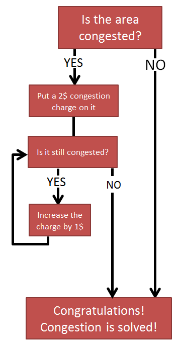 |
| The Easy Solution to Congestion... I'm only partly facetious, it's politically suicidal, but it would work |
However, it has its issue. For one thing, it can be very hard and expensive to do, because creating such a zone in a heavily gridded city means there is likely to be dozens of streets through which vehicles can enter the zone, and if only the major arterials are controlled, you can push vehicles to use detours on residential streets to avoid paying the charge. If the city is on an island or separated by rivers and there are a few bridges only to connect to the suburbs, it can be much more easily done.
 |
| A theoretical congestion charge zone for Montréal, relatively easy to do thanks to the location of the city on an island... |
 |
| ...but in Toronto, it would be extremely complicated to apply because there is no obvious boundary and any border would cut through a lot of streets, including small side streets |
If the city is at the center of the region's highway system, a congestion charge may also make it hard for people to move from one suburb to another, which would generate a lot of backlash.
Finally, the biggest problem with the congestion charge is that, just like letting congestion do the job on its own, it concentrates its effects on the city itself while leaving suburbs unaffected, or less affected. As a result, if the city is not a big enough draw on developments already, it can instead hurt it, as industries and offices flee outside of the congestion charge zone to avoid employees and trucks paying the charge. So it can be a sprawl incentive as only people who live and/or work inside the city are affected by the charge. So, in effect, it reduces car use inside the city, but it may push developments outside the city.
Tolling high-speed roadways
This is an approach I've often spoken in favor of and which can be seen as an user-payer approach, as high-speed roadways are very expensive to build, and the current way of funding them through licensing fees and gas taxes subsidizes suburban sprawl by making cities pay more than their fair share of high-speed roadways. Tolling highways have the secondary effect of making long travel trips much more expensive, which is the reverse of a gas-tax funded highway which both saves users time (being faster) and money (as they use less gas per distance traveled), a practice that enables people to live much farther than they would otherwise. With tolls, this imbalance can be somewhat corrected, and with tolls being an upfront, marginal cost, the impact is much greater than a yearly fee or tax.
For example, here is a theoretical comparison between 5 trip choices, supposing a time value of 20$ per hour:
For example, here is a theoretical comparison between 5 trip choices, supposing a time value of 20$ per hour:
- A commute from a suburb 20 km away on an highway, without toll
- A 10-km commute from an inner suburb on lower-speed roads
- The first 20 km commute but with a 10 cents/km cost added
- A 10-km bus commute with a monthly pass (so no marginal cost)
- A 20-km bus commute with a monthly pass also
 |
| Comparison of different scenarios |
Once you add a toll to the highway, the 10-km car commute becomes the cheapest option. The actual monetary cost (excluding time) is also 3 times higher than with the car commute, so that the annual cost, just in variable costs, is about 1 500$ higher for the 20-km highway commuter over the 10-km urban car commuter. That is not a negligible difference.
A great thing with this approach over the congestion charge approach is that tolling highways increases the cost of ALL long distance trips, and not just trips to the city core. So people can't simply escape the fees by moving to suburbs and finding jobs in other suburbs.
 |
| With a congested central city and/or a congestion charge, developments (homes AND jobs) tend to flee to suburbs to avoid the congestion in the center, favoring inter-suburb trips |
 |
| With tolled highways, inter-suburb trips are just as expensive as working downtown, so developments tend to gather in nodes to reduce distances, thus reducing or eliminating the need to use highways for many residents |
Building low-cost, high-capacity, low-speed road networks
This is totally different philosophy to building road networks. Some urbanists think that road capacity induces demand, I disagree strongly, it is road SPEED that induces demand, because it lowers travel costs and makes it more affordable to travel longer distances. By that reasoning, a strong grid of low-speed roads would yield high capacity, allowing freight and service vehicles to move reasonably fast, while not inducing too much vehicle demand.
Examples of this approach can be found in Japanese and European cities, where high-speed roadways skirt around urban areas, but with a high number of major streets in cities that have low speed limits.
The advantage of such a system is that low speeds keep vehicle demand relatively low as alternatives like transit and bikes are more competitive with cars on city streets. It also makes far-flung suburbs disconnected from the downtown area because the highways fall well short of it, forcing suburbans to travel half the city on slow arterials to get where they want to go inside it.
The problem of this approach is a risk of the creation of a semi-independent edge city around the highways that skirt the town if no measure (toll, planning) is taken to prevent it, which will eventually congest that peripheral highway, complicating long-distance trips and road freight much.
Now, I know what some may say: this is all fine and good, but that option seems to be valid only if we start from scratch what if we already have a hierarchical road network with plenty of highways inside our metro areas?
The answer is that you can gradually transfer over to that system by converting highways to boulevards like some cities did, and applying traffic-calming measures on major arterials to slow traffic down.
Examples of this approach can be found in Japanese and European cities, where high-speed roadways skirt around urban areas, but with a high number of major streets in cities that have low speed limits.
 |
| Munich, Germany, the highways are in orange, see how they circle the city but do not enter it, average speed on urban arterials without congestion, according to Google Maps, is about 25-30 km/h, 15 to 20 mph |
 |
| Sendai in Japan, another example of highways avoiding the urban area, but with a strong grid of arterials inside the city, according to Google Maps, without congestion, the average car speed on these arterials is 25 km/h, 15 mph |
The problem of this approach is a risk of the creation of a semi-independent edge city around the highways that skirt the town if no measure (toll, planning) is taken to prevent it, which will eventually congest that peripheral highway, complicating long-distance trips and road freight much.
Now, I know what some may say: this is all fine and good, but that option seems to be valid only if we start from scratch what if we already have a hierarchical road network with plenty of highways inside our metro areas?
The answer is that you can gradually transfer over to that system by converting highways to boulevards like some cities did, and applying traffic-calming measures on major arterials to slow traffic down.
Limiting parking or increasing parking costs
Parking is also a crucial method of solving congestion issues with economics. Indeed, every SOV trip begins and ends with a parking spot, so if there is none in close proximity to the destination, that is a major deterrent to vehicle trips. Any parking fee also becomes part of the cost of traveling with a personal vehicle. So if parking is expensive, then it provides a strong incentive to find another way to get to the destination. If parking is limited, then it imposes a hard limit on the number of people who can come there by car, though in that instance too parking prices should increase a lot, as a way of rationing parking spaces.
As far as examples go, Calgary is an example of a city that let downtown parking prices rise very high. The average downtown parking spot going at over 450$ per month, which is very high for a city with just over 1 million people. Ottawa is an example of maximum parking limits, especially downtown. The result of Ottawa's policy is a very high transit use by downtown commuters, that some credit to Ottawa's BRT... except that the high transit use was present long before the BRT, which opening is not associated with any increase in transit use.
The same can go for residential parking, which is even more crucial, because if people do not have a place to park their car at home, they can't even own one, and if they can't own one, they can't use a car to get around, at least not regularly. The presence of on-street parking can short-circuit this process as people may simply park on the street without having to pay for a spot, which is why residential parking permits make a lot of sense.
On a tangent, many cities currently limit population and job densities in areas to keep vehicle traffic at a manageable levels. Except that is based on the supposition that, no matter what. people are going to travel by cars, or maybe that being able to own a car and to use it is a basic right. In fact, people have different ways of getting around, and those without cars are even forced to find other ways of getting around. So if you want to limit vehicle trips to avoid congesting the road network, instead of restricting population/job density, why not restrict vehicle density by restricting the number of parking spots available? That way, you can restrict vehicle trips without actually restricting development unduly.
Anyway, limiting parking or having higher parking fees is a bit like a congestion charge as in they mainly target people who go downtown or any dense areas, because in lower density areas, parking is likely to be more abundant and affordable, if not outright free.
Of course, for rapid transit to be really useful, you need to connect it to concentrations of jobs and homes, and gather developments around it, to optimize the investment. It's also important for rapid transit to go BEYOND the current limits of developments to really go through the entire metropolitan region. This reduces transfers (and every transfer increases travel time by 5-10 minutes) and helps shape developments in suburbs to be built around transit rather than around highways. Some people may say that building rapid transit is too expensive to do that, but remember that once in low-density areas, you can build rapid transit on the surface for little more than you'd pay to build the highways that are likely already there.
As far as examples go, Calgary is an example of a city that let downtown parking prices rise very high. The average downtown parking spot going at over 450$ per month, which is very high for a city with just over 1 million people. Ottawa is an example of maximum parking limits, especially downtown. The result of Ottawa's policy is a very high transit use by downtown commuters, that some credit to Ottawa's BRT... except that the high transit use was present long before the BRT, which opening is not associated with any increase in transit use.
The same can go for residential parking, which is even more crucial, because if people do not have a place to park their car at home, they can't even own one, and if they can't own one, they can't use a car to get around, at least not regularly. The presence of on-street parking can short-circuit this process as people may simply park on the street without having to pay for a spot, which is why residential parking permits make a lot of sense.
On a tangent, many cities currently limit population and job densities in areas to keep vehicle traffic at a manageable levels. Except that is based on the supposition that, no matter what. people are going to travel by cars, or maybe that being able to own a car and to use it is a basic right. In fact, people have different ways of getting around, and those without cars are even forced to find other ways of getting around. So if you want to limit vehicle trips to avoid congesting the road network, instead of restricting population/job density, why not restrict vehicle density by restricting the number of parking spots available? That way, you can restrict vehicle trips without actually restricting development unduly.
Anyway, limiting parking or having higher parking fees is a bit like a congestion charge as in they mainly target people who go downtown or any dense areas, because in lower density areas, parking is likely to be more abundant and affordable, if not outright free.
Invest in rapid transit
If you look at the economic comparison between modes above, you can notice that regular local buses do very poorly in the comparison, even compared to commutes twice as far on tolled highways. To make transit more attractive, you can try to reduce the cost of tickets, but that is not why transit is not used that much in general. With monthly passes, the marginal cost of transit use is even 0$, so it's hard to see how you could do better by subsidizing transit more. The issue is the cost of transit use in time, so to attract people to transit, it's best to have rapid transit.| Rapid transit makes transit competitive in terms of marginal cost, which local buses generally fail to do |
Conclusion
OK, so this was a very long post, but I think it gives a good idea of ways to deal with congestion that doesn't entail a ponzi-like ever-escalating flurry of road building and rebuilding. Of course, all of these approaches are politically hard to apply, when people are used to having something to use for free for so long, any change that has them paying more, even if fully justified, will be a hard sell. However, unless we agree to be honest about our choices, these alternatives will never be properly discussed and considered.