People in urbanist circles talk a lot about TOD, Transit-Oriented Development. I've personally described one clear example of it when talking about streetcar suburbs. But I think it's important to look at other forms of development too, especially the current type of development which might be called car-oriented development. It's very important because:

- It's important to understand how we've built cities if we want to reform them into something better, to see how they can be gradually migrated to a better form of development
- Car-oriented development has been amazingly effective at spreading itself, trying to understand how it propagates and sets the stage for its success can be useful to conceive of how TOD can hopefully replace it
- To understand its pattern of replication so as to know when we are doing it, so we can avoid that trap
Basics of car-oriented development
- Residential areas
 |
| These two images are from Swindon, UK - 85% car mode share |

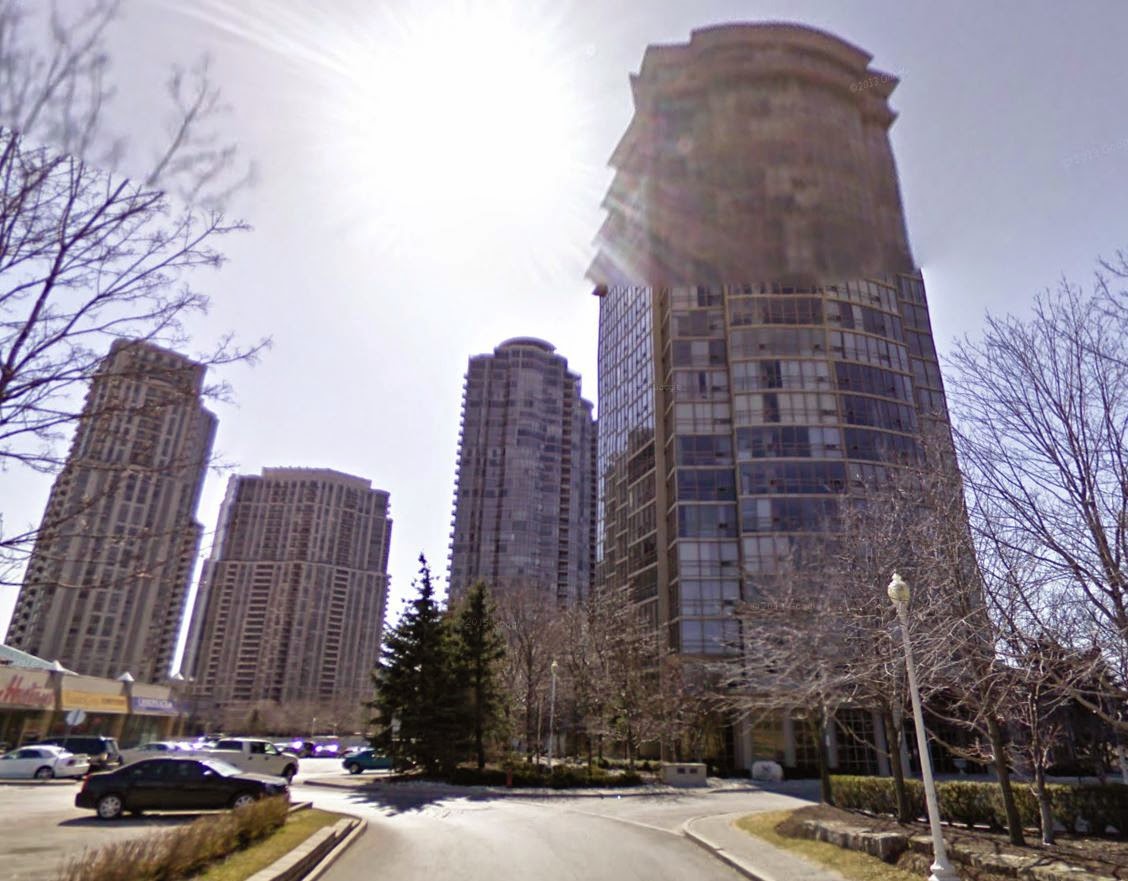 |
| Mississauga, Toronto's car-dependent edge city |
What COD requires is to have plenty of residential parking everywhere so each working adult can find a parking spot for his car. That means in general having at least two parking spots per house, with on-street parking to deal with the overspill. This requirement does cap density, but it still allows for some. For instance, a 6-meter wide (20-foot) townhouse on a lot 30-meter deep (100-foot) could have a driveway that could have 4 cars parked on it, given a large enough setback. Such a house could get a density of around 40 units per hectare. 40 units per hectare with single-family houses can yield a population density of around 9 000 to 10 000 people per square kilometer (22 000 to 25 000 per square mile). Even single-family detached houses can achieve decent density, the Japanese achieve 30 to 40 units per hectare with SFD housing, mainly by having shallow lots (around 15- or 20-meter deep lots, 50- or 70-foot).
 |
| To scale, 9 houses in Japan (3 deep plus a street, 3 across) vs 3 houses in Vancouver, Canada |
With multi-family housing, density can be even higher. This often looks like towers in parking lots, but density can even reach 100 units per hectare (40 units per acre), or even more if you use storied parking, either in aboveground structures or underground parking lots.
Of course, if you want to avoid having cars everywhere, making areas ugly as sin, and don't want to use expensive underground garages, the density limit of parking requirements is even tighter.
Likewise, in consideration of the residents, there needs to be ways to force through traffic off of residential streets, often resulting in cul-de-sac and the like.
- Retail and job centers
The location of these centers is also very important, and tends to depend on three important factors:
- The catchment area
- The local traffic
- The capacity of the road network
The local traffic is sought especially by small stores, because it opens the door to a lot of "pass-by" customers, people who may not make a trip just to go there but who will stop and shop there if it's on their way. Donut/coffee shops thrive on pass-by customers for example.
The road capacity of course matters because if it's insufficient to deal with the expected traffic, then some customers will turn back, or some employees will actively seek other jobs.
All of these factors combine to explain why stores locate on arterials, these areas tend to be accessible to the largest amount of people, to already have plenty of traffic and relatively high capacity.
- The road network
Street-based car-oriented development
First, what does a car-oriented city based on regular streets look like?
Cities following a street-based COD actually develop not that much unlike traditional cities, in that they would tend to be relatively round, with a strong center. Why? Because if all streets go at roughly the same speed, say around 30 km/h on average (including stops), then growth will tend to happen in a concentric fashion to reduce the travel time to all other areas of the city, just as they would in traditional cities where most people walked. The main difference is one of scale.
Likewise, the center of a city is by definition the most accessible part of it. It is the part of the city that is closest to every other part of the city on average. Also, supposing an uniformly distributed population, the center also has the highest road capacity of all areas as exactly one quarter of the population is likely to access it by the north, by the east, by the west and by the south:
 |
| The center doesn't just reduce the maximum distance, but also distributes people coming into it to 4 directions equally, in this case, if every street in has a capacity of 2 000 vehicles per hour and there are 6 000 vehicles per hour coming into the downtown area, then each street is at 75% of capacity |
Meanwhile, a retail and jobs center that would not be at the center would face a much higher traffic coming from one direction than from the other directions, risking congestion and becoming undesirable to go to for people who are stuck on that particular way in.
 |
| An off-center location results in a lot more people coming in from one or two directions, in this case, using the data from the previous image, the west access is probably at 150% of capacity, the north access is at 100% of capacity while the east and south access are at 25% capacity, so most people coming to the center would come through congested streets |
Major stores would likely be located in the center, with some proximity stores on arterials all over the city.
As a city grows, it may come to limits on growth, the arterials leading to the center may become congested, the city may grow beyond what would be considered acceptable travel distance (in minutes) from the center, which can be dealt in a variety of fashion: creating new centers on the periphery, with new residential developments to follow, creating a polycentric city, investing more in transit to increase road capacity for peak hours, widening streets, etc...
A street-based car-oriented city is not so bad. Sure, residential and commercial forms give priority to cars rather than to humans, but since there is no high-speed road and speed is largely the same on all arterials, there is a focus on reducing distance and on being more compact rather than spread out. Transit can also be effective with bus lines on arterials following the same routes as cars. There is no street off-limits to pedestrians and cyclists, though crossing some streets may be long and unpleasant, it remains a possibility.
Highway-oriented development
Highway have a big impact on traffic and development patterns. Since they are much faster than regular streets, people often have an advantage to take detours by the highway instead of traveling slower on city streets. The result of highways is thus a concentration of traffic on the highway, drawing them away from arterials. Highway interchanges also become the most accessible places with the biggest catchment areas of the entire region: |
| 10-minute driving distance between an interchange versus an arterial far from highways |
- Opening the way for more sprawl
- Draining traffic off of existing commercial arterials
- Attracting commercial businesses and employment centers to highway exits
The result is that you will see malls and big box stores springing up at highway exits while arterial commercial streets will weaken. As much as we can find strip malls ugly, they are still a lesser evil compared to big box stores located at highway exits.
What is the big problem with highway locations? Well, first of all, they tend to be located far from population centers, at the periphery of urban areas, not at the center. Second, the highway itself creates a barrier imposing a huge detour to get to the area for those on the wrong side of the highway, including for pedestrians walking along extremely wide arterials with plenty of fast traffic. Third, unlike the earlier arterials, it is hard to serve an highway with transit. On the arterials, buses could stop frequently, and even with parking lots, people would still be in face of the businesses, but buses can't stop on highways in general, even if they did, they would leave riders in an eminently unpleasant location, far from everything.
So not only are these commercial areas distant from population centers, there are barriers imposing detours, walking or biking there is uncomfortable if not outright dangerous and transit service will usually be terrible. The only ones advantaged by locations at highway exits are car drivers.
Here is an example of highway-located malls in Atlanta to illustrate my point:


Note how commercial areas (that can be easily identified by the prevalence of gray color due to the parking lot pavement and the roof of big box stores and malls) congregate directly at the highway exits, with residential areas (identified by the green with small gray line patterns) further out. In the second case, the mall is even enclosed by two highways running parallel to each other for a while, forming a significant barrier to direct trips.
Now, let's see examples of malls in street-based car-oriented developments. Once again, I turn to Japan, because that's where this kind of development is most seen, even European cities use relatively higher speed arterials (though nowhere near the highways of North America).
 |
| An AEON mall in Obihiro, put inside a residential area, do not mistake it for a huge parking lot, it's just the parking on the roof that gives that impression |
 |
| You can see the AEON sign in the background, with a 8-story residential building in the foreground |
 |
| Another AEON mall marked by the red "F", in Asahikawa |
 |
| What it looks like from the street |
These two examples of malls in car-oriented Japanese cities. We may not like how they look like, but they are built inside residential areas and can be walked or biked to, unlike the Atlanta malls. The price of land compelled the owners to build parking on higher stories to be able to fit their stores in smaller lots. I'm not saying this is perfect, not at all, but they are way less bad than highway-oriented developments.
Conclusion: how to avoid HOD and what we can learn from it
Highway-oriented development is not just a form of development that favors cars, it is one that essentially punishes any other mode of travel. A street-based car-oriented development at least allows for other modes of travel to exist and even the possibility of conversion if need be. HOD has no redeeming features whatsoever for sustainability and multi-modality. To avoid it, there are two main solutions:- Do not build any highways inside urbanized areas, or even high-speed arterials (what Charles Marohn at Strongtowns calls Stroads). Build highways so that they go around cities and do not penetrate them, with very few exits very spread apart, this will reduce the catchment area of highways and avoid them being used for local trips. Local car traffic should be dealt with by a tight grid of lower-speed arterials with frequent intersections (high capacity, low speed, low cost).
- Toll highways high amounts, 10-20 cents per km (15-30 cents per mile). This can be justified by the high cost of building and maintaining them. Tolling highways will significantly reduce demand for it, and commercial developers will want to avoid locations that require people take highways to access stores and job centers, because the tolls will be a constant irritant to potential customers.
As bad as it is for sustainability and as wasteful as it is, HOD is incredibly successful at imposing itself, so taking inspiration from it for TOD makes all the sense in the world.
Great post!
ReplyDeleteI like how you mentioned highways add land encouraging sprawl. I came to the same conclusion when I was writing my blog post on density without zoning ( http://www.strongtowns.org/journal/2014/7/16/density-without-zoning.html ). Without zoning, density is reduced to a ratio of Population:Area. 'Area' is the amount of accessible land within a reasonable amount of time (This differs for everyone as for some people 'reasonable' may mean 30 minutes. For some it may mean 10 minutes.) Building a highway or a rapid transit line adds to the supply of land, decreasing density.
A pedestrian city would be built at a smaller scale than a bicycle city. A bicycle city would be built at a smaller scale than a car city. A car city would be built a a smaller scale than a highway city: http://www.andrewalexanderprice.com/images/blog37-5.png
If we build highways, car-oriented streets, bike-oriented streets, pedestrian-oriented streets we're going to attract that scale of development.
In the area I come from in Australia, our local mall was within walking distance of many houses. But the mall was not just a retail destination, but it contained everyday needs - bank branches, pharmacies, supermarkets, fish shop, council offices.
https://maps.google.com/maps?q=-34.875158,138.601304&ll=-34.875545,138.602282&spn=0.005316,0.010461&num=1&t=h&z=17
Some of the wealthier neighbourhoods are even more integrated. You have multiple indoor malls that blended seemlessly into the surrounding local shops. There are post offices, movie cinemas, cafes, hardware stores, all within 'pleasant' (not having to cross highways or parking lots) walking distances of the homes. As a result, this was on the most expensive areas of the city to live in:
https://maps.google.com/maps?q=-34.875158,138.601304&ll=-34.921188,138.636078&spn=0.005313,0.010461&num=1&t=h&z=17&layer=c&cbll=-34.921214,138.635543&panoid=DOZrZm-bWCPDKclfPgF6XQ&cbp=12,336.39,,0,6.83
Adelaide looks like a decent street-based car-oriented city (as cars still dominate mode share) with retail well integrated for the most part into a porous street grid and little high-speed roads in urban areas. It looks like it has quite a bit of potential for more transit and active mode use. It's just that density seems to be a bit lacking. Indeed, from what I can find, 12,9% of all trips are already done on a bike or on foot, 3 times as high as American cities (http://www.atrf.info/papers/2002/2002_Stopher_Bullock_Rose.pdf).
DeleteGreat minds think alike on the impact of high-speed modes of travel and density. Still, I think the density of density matters, rapid transit does allow density to spread around, but without zoning, or with lax zoning, it results in high-density nodes around stations, high-density nodes that can be even higher than what the city would look like without rapid transit (without it, streets would congest and this would limit density locally, so you would have density spread around rather than at nodes).
In a broader sense this discussion raises the question of what the optimal access/mobility balance is for various modes. More access leads to reduced speeds and thus lower overall mobility. The highway, like the railroad, should put mobility, and thus speed and distance, above access. They're links between places, not circulators within places.
ReplyDeleteBack in the day we had commuter railroad stations and local, limited, and express services to try to achieve both fast high-mobility services between big cities and slower more accessible services to smaller cities and suburbs on the same route. Rapid transit systems, like the Chicago 'L' for example, were originally built with almost ridiculously close stop spacing, like a quarter mile, because the neighborhoods wanted the shortest walk possible, even offering to build the stations themselves in some cases. Over time many of those stations had to be whittled away due to lack of ridership and the poor operations they caused.
Highways were co-opted by the "we need access" arguments too. After all, if a neighborhood has to contend with the noise, pollution, and destruction of their street grid, shouldn't they be able to actually use the highway too? Of course that leads to wasteful trips, congestion, and bad development patterns. Urban interstate highways are like the highest level stroad in a way, too congested and with too many exists and ramps (accesses) to provide fast travel speeds (mobility), but also too unpleasant for anything but the most low-value development to happen near it.
Some of the more regimented interstate highways with express lanes, or limited access toll routes (like the Dulles Highway in northern Virginia) act a bit more like railroads with the different levels of service, rather than the stroads that try to be everything to everyone but achieving nothing for anyone. Still, it seems like we never seem to get this right. A while back an example was given of one Japanese city (not Sapporo) where the heavily-tolled highway skirts the edge and doesn't enter the city at all, with only one or maybe two accesses to the city. That seems like a good way to do it, but then what about development trying to concentrate around those access roads too? Tough situation.
Excellent article as usual.
ReplyDeleteI think another thing we can learn from car-oriented development (especially car-oriented malls) is how to accomodate cars with minimum space and minimum cost (per car, though of course the costs add up if you have lots of cars).
Malls typically have surface parking, which avoids both the cost of structured parking and also the bulk of ramps, which take up much more space than stairs or elevators for people. They typically have their parking spots arranged around narrow traffic lanes which are used both by cars driving slowly and pedestrians. The malls I know keep the perimeter of the building free of car parking so that people, cars and trucks can circulate more freely.
If we built a fairly narrow local street with the same ideas, it might give 2 narrow traffic lanes shared by pedestrians and vehicles, each flanked on the outside by the building or its buffer area and on the inside by parking. The parking might be a single row of angle parking where cars could back in from either side, and it could be priced to always keep a few free spots, which among other benefits means that there wouldn't be a solid wall of cars dividing the street in two. This would be narrow by current North American standards but provide much more street parking than your Japanese examples.
Does this kind of thing get built and if not, why not? Would it be too hard to get in and out of the parking spots unless the traffic lane was quite wide? Would there be too much friction between pedestrians (who would presumably want to use each lane in both directions) and vehicles (who would use each in a single direction)? Is it a problem with emergency vehicle access?